The first hint comes quietly, on a grey January morning when the cold doesn’t quite feel like real winter. You step outside, expecting that sharp, biting air, and instead there’s a soft, almost springlike breeze brushing your face. The forecast on your phone says “unsettled,” a vague word that suddenly seems to describe the sky, the wind, even the way birds circle higher than usual.
On TV, a weather map flashes briefly: a ribbon of white and blue curves across the North Atlantic, not where it should be. The presenter’s tone is calm, but the words stand out: “The jet stream is shifting early this year.”
You look at the map again, that strange wavering band that secretly drives your winter.
Something in the atmosphere is turning the page too soon.
What an early jet stream realignment actually looks like on the ground
Across Europe and North America, forecasters are staring at model runs that look more like late February than deep January. The polar jet stream, that high-altitude river of fast-moving air, is already bending, dipping, and looping in ways that usually arrive weeks later.
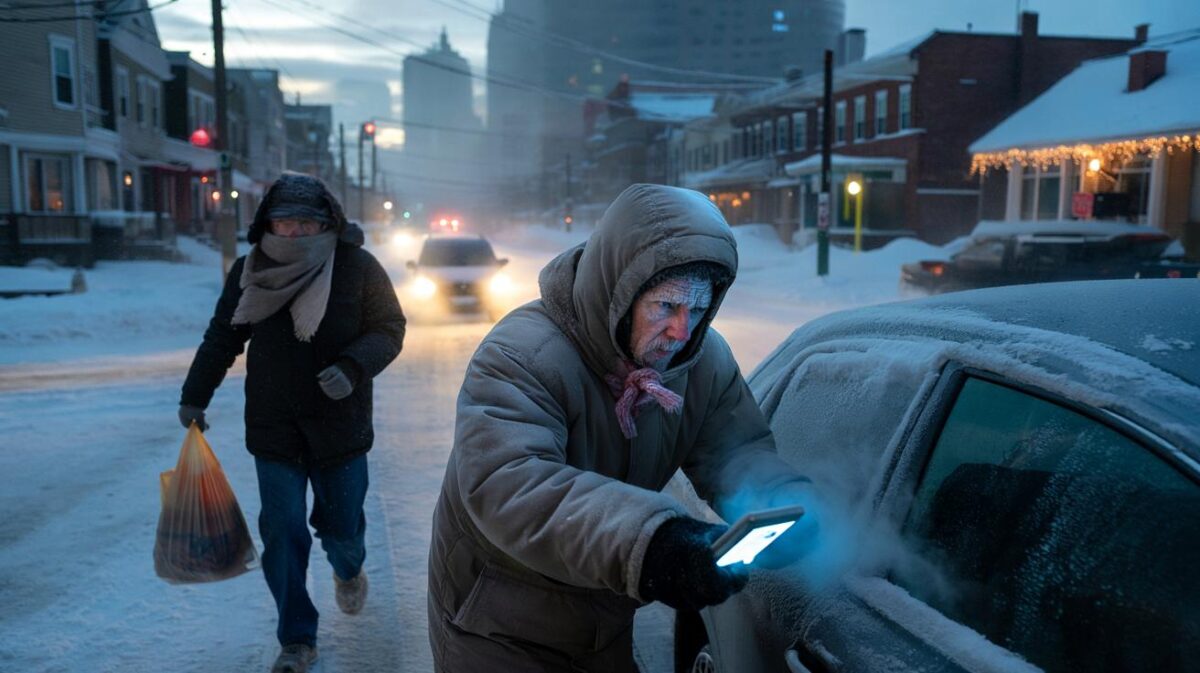
On the ground, that means odd pairings: icy air brushing against pockets of almost warm rain, sunshine followed by sideways sleet, calm days smashed apart by sudden storm warnings. For people who read the weather like a second language – farmers, road crews, energy traders, parents planning school runs – the timing feels off. Winter seems to be improvising.
Take the UK as an example. Last year, the jet stream sat sluggishly to the south well into January, funnelling storm after storm across the country. This year, early data from European and American weather centres shows something stranger: the stream is starting to kink north and south like a loose fire hose, much earlier than usual.
On the other side of the Atlantic, US forecasters report similar patterns. A strong ridge of high pressure out West, a deep trough over the central states, rapid swings in temperature in the East. One week, Denver gets a brutal Arctic blast. The next, Washington DC is ten degrees warmer than the seasonal norm, with heavy rain instead of snow. The calendar says midwinter. The maps say “transition season.”
Meteorologists talk about the jet stream as though it’s alive, because in a way, it is. It responds to contrasts in temperature between the equator and the poles, to ocean heat, to snow cover, to the chaos of the atmosphere itself. When that temperature contrast weakens – as happens in a warming world – the jet can slow, wobble, and meander.
An early realignment means the balance of those forces is shifting faster than usual. Some scientists point to lingering warmth in the North Atlantic and unusual sea ice patterns in the Arctic. Others highlight the recent El Niño adding extra energy into the global circulation. All agree on one thing: the timing of this jet stream shuffle is atypical, and it stacks the deck for more “weather whiplash” events in the weeks ahead.
➡️ China’s new 22 km tunnel marks an engineering miracle and a controversial monument to state power
➡️ Bosch finally explains how fridge magnets affect your electricity bill
How to live with a sky that won’t stick to the script
When the jet stream misbehaves, the worst thing you can do is rely on the old mental calendar in your head. “January means stable cold” or “storms come later in the season” – those shortcuts start to fail. A more grounded approach is to shorten your planning horizon.
Instead of locking in rigid plans weeks ahead, watch the 5–7 day forecast with a bit more respect. Look not just at temperature, but at the words around it: “wind gusts,” “heavy rain,” “freezing rain,” “rapid change.” These are classic fingerprints of a restless jet stream overhead. Adjust travel, outdoor work, and even home DIY around those windows. It feels mundane, but this is how you quietly stay one step ahead of the atmosphere.
We’ve all been there, that moment when the forecast said “light showers” and you ended up driving home through a mini-monsoon. With the jet stream realigning early, that kind of mismatch can become more common, especially in regions under those looping, wavering sections of the flow.
One practical habit is to layer your decisions, not just your clothes. Don’t cancel everything at the first storm alert, but don’t ignore it either. Have a “plan A” for fine weather, and a “plan B” if the wind shifts or the rain intensifies. That applies to farmers timing their planting, builders working at height, or parents deciding whether the morning commute is safe. Let’s be honest: nobody really checks the hourly radar every single day. But in weeks when forecasters mention the jet stream repeatedly, it’s worth doing exactly that.
The people who track this for a living are unusually blunt right now.
“An early realignment of the jet stream doesn’t guarantee disaster,” says a senior forecaster at a European weather service, “but it does guarantee surprises. The atmosphere is moving into a more reactive mode, and that means we all have to be a bit more reactive too.”
That “reactive mode” can feel exhausting, so it helps to turn it into a simple checklist you can run through without drama:
- Check a trusted forecast twice a week, not once.
- Look for words like “strong gradient” or “deep low” in regional outlooks.
- Keep gutters, drains, and balcony outlets clear – flash downpours love clogged exits.
- Review insurance photos of your home and car before the stormiest weeks.
- Talk with neighbours about who might need help if power or heating drops.
*None of this is glamorous, but it’s exactly how households quietly become weather-resilient while the jet stream redraws its path above them.*
What this early shift tells us about the winters ahead
The jet stream’s early twist this January won’t be a one-off headline that disappears once the next storm system has passed. For many researchers, it’s another data point in a longer story: winters becoming less predictable not just in temperature, but in rhythm. Seasons that used to have a clear “shape” – cold, then snow, then a gradual thaw – are now jagged, full of false starts and abrupt turns.
That doesn’t mean every winter will be mild or wild. It means the old expectations we grew up with are losing their grip. A single cold snap no longer proves that nothing is changing. A run of warm days doesn’t either. What begins to matter is the pattern of strange timing: snow in months that used to be calm, rain where you used to bet on ice, wind that rises faster than the warnings can keep up.
For you, this isn’t just about watching dramatic satellite loops on social media. It’s about the small, real-life decisions that add up. Do you buy snow tyres this year if your region now swings between heavy rain and freezing conditions? How does an early jet stream shift affect heating bills, or school closure days, or the odds of your next flight being delayed by crosswinds?
These aren’t abstract climate questions; they’re household planning questions. The plain truth is that **our routines evolved for a steadier atmosphere than the one we’re now living under**. So we start to tweak those routines. Checking storm windows earlier. Adding wind resistance to backyard projects. Scheduling key events in quieter forecast windows instead of on arbitrary calendar dates. Small, slightly boring changes – the kind that quietly protect your time, your budget, your nerves.
Meteorologists will keep refining the models, arguing over temperature gradients and ocean heat content, debating how big a role climate change is playing in each new twist of the jet stream. You don’t need to follow every technical thread. What you can do is treat this early January realignment as a kind of signal: the atmosphere is evolving, and our habits will have to evolve with it.
You might notice yourself looking up more often, listening differently to forecast language, comparing what was expected with what actually arrived. You might share those observations with friends, almost like trading neighbourhood weather notes. **That’s not paranoia; it’s adaptation**, quietly beginning at street level.
The jet stream will keep sliding and bending in the blue heights above us, invisible yet decisive. Down here, between school gates and supermarket car parks, the question is simple: how do we live well in a world where the sky keeps rewriting its own winter script?
| Key point | Detail | Value for the reader |
|---|---|---|
| Early jet stream realignment | January patterns resembling late winter, with stronger swings in temperature and storms | Helps readers understand why the current weather feels “off” compared with past years |
| Shorter planning horizon | Focus on 5–7 day forecasts, radar checks during unstable weeks, flexible Plan A/Plan B | Reduces disruption to travel, work, and family life during rapid weather shifts |
| Everyday resilience habits | Simple steps: clear drains, follow storm language, coordinate with neighbours | Turns abstract atmospheric changes into concrete, protective actions at home |
FAQ:
- Will this early jet stream shift make winter milder or harsher?Neither, in a simple sense. It raises the odds of extremes on both sides: sudden cold snaps, unseasonal warmth, and more intense storms clustered into shorter periods.
- Is climate change causing the jet stream to realign earlier?Scientists are still debating details, but many studies link a warmer Arctic and warmer oceans to a weaker, wobblier jet, which makes unusual timing and patterns more likely.
- Should I change how I plan travel in January?Yes, slightly. Check forecasts more often, allow extra buffer time around stormy days, and prefer flexible tickets during weeks when forecasters highlight strong jet stream activity.
- Does this increase the risk of flooding where I live?If you’re in a region prone to winter storms, a restless jet stream can mean heavier, more persistent rain events. Local flood history and topography still matter most, though.
- How can I follow jet stream forecasts without being an expert?Look at national meteorological service maps, watch for mentions of “strong jet” or “active storm track,” and compare those notes with your local 3–5 day forecast to see how it might translate on the ground.